St Pancras to Canary Wharf

This half-day walk takes in a part of London undergoing massive regeneration, along a waterway that changed the city. Stay along the canal or break up the journey and explore different areas along the way: Kings Cross, Islington, City Road, Victoria Park, Millennium Park, Limehouse & Canary Wharf.

Factbox ¦ Route map (full sizePhoto gallery

St. Pancras is less than 10 minutes away by Thameslink. Finding Regent’s canal from the station is a tad confusing amid the hustle and bustle. Once on York Way, walk north to the towpath. It’s by the entrance to Granary Square, London’s newest square and part of the regeneration of Kings Cross. You can stop and play in the fountains (just avoid getting splashed) and walk around the new campus for Central St. Martin’s College. Be careful taking photos if you have a tripod – security may try and make you sign a release form as it’s a private square.
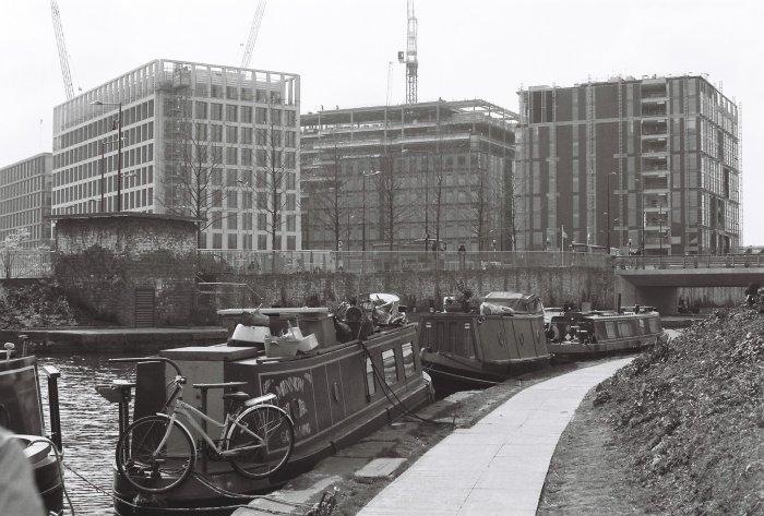
New offices in Kings Cross from the canal

New offices in Kings Cross from the canal

The towpath is on the left side of the canal (facing east). Ahead of the Caledonian Road Bridge, you can see Battlebridge Basin opposite. It’s a standard wharf development apart from the Kings Place office block on the right had side. This is the HQ of the Guardian and is also open to the public as a cultural venue. The London Canal Museum is in a building opposite the towpath but that’s for another day.

The path then takes you up to Muriel Street as the canal enters the 846 metre long Islington tunnel – the longest canal tunnel in London. Continue on the footpath into Maygood street, turn right on Penton Street and left onto Chapel Market. This street market is open Saturdays 10am-5pm and Thursdays 12-6pm (mini market – no food). There are also a few independent shops and restaurants should you want a bite to eat. Chapel Market ends on Liverpool Road. Once there, you cannot miss the large N1 shopping complex but I’d walk straight through onto Upper Street and then Duncan Street. The towpath begins again after Duncan Terrace and Colebrook Row Gardens. These are well-kept small public parks and worth a wander around.
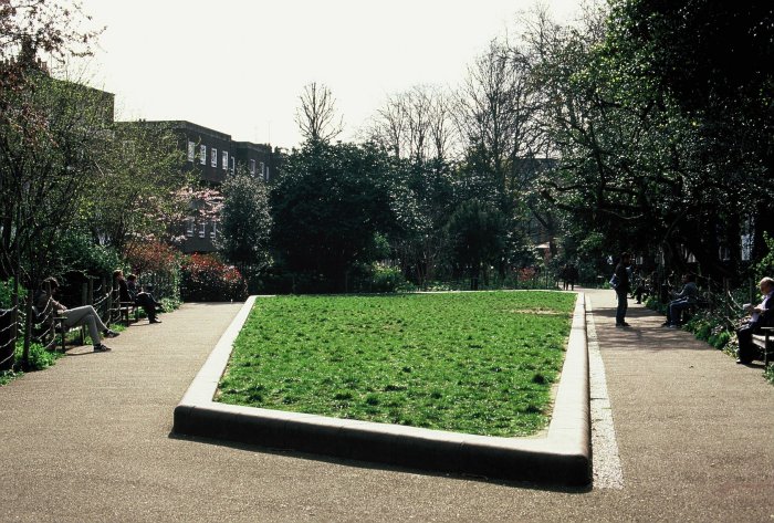
Stop and have a sandwich in Duncan Terrace Gardens

Stop and have a sandwich in Duncan Terrace Gardens

Take the towpath on the left hand side and head in the direction of City Road Basin after the City Road Lock. This basin and the areas surrounding it are undergoing a full scale regeneration. Until recently, it was closed to the public and derelict. Now new high rise buildings are coming up fast. There is also public open space at the foot of the basin.
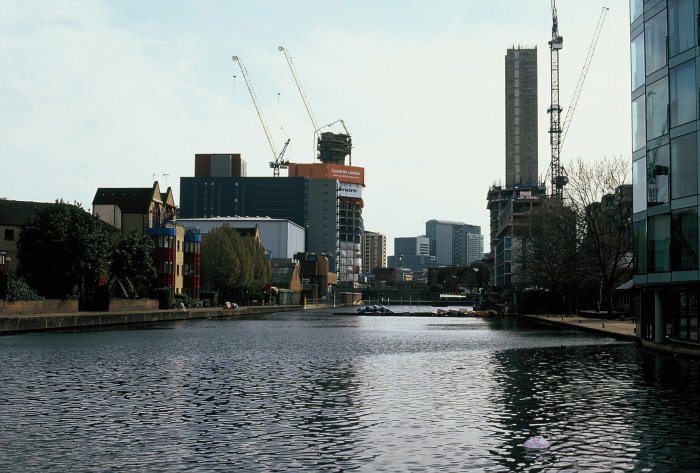
City Road Basin - previously derelict

City Road Basin – previously derelict

Continue under the Wharf Road bridge to Wenlock Basin. Keep walking though as the basin is private and open to residents only. The path in Hackney is improving – a few years ago, it was rather empty. However, the area’s proximity to fashionable Hoxton has meant one or two canal side cafés and restaurants have opened up near Kingsland Basin.

Kingsland is a basin on the north side of the canal. Although it’s seeing redevelopment, the Canals in Hackney Users Group (CHUG) was formed to help dredge it and generate affordable housing around the edges. There is a small community of houseboats along this section of the canal and CHUG maintains the moorings.

If you exit the canal on Kingsland Road, you can explore the hipster territory of Hoxton. Again, Hoxton has seen huge changes over the past decade, not to everybody’s taste. If you want to explore and avoid hipsters, the Geffrye Museum is nearby.

Another potential detour is strictly for Eastenders fans. Fassett Square, the inspiration for Albert Square, is nearby but in the opposite direction to the museum. Otherwise, back on the towpath. You will pass the Transition Gallery. If you are into modern art then there may be an exhibit worth wandering around. Walk underneath the railway and the Mare Street bridge and reach Victoria Park.
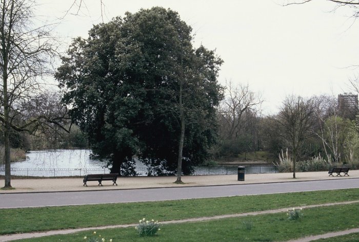
Victoria Park from the canal

Victoria Park from the canal

The canal goes right alongside the park , merely scratching the surface of its 86 hectares, which have been refurbished in the past few years. It has been consistently voted as one of Londons favourite parks and has three boating lakes.

After Victoria Park is Mile End Park. This was where 60,000 Men of Essex met Richard II’s forces in battle during the Peasants Revolt in 1381. It is one of Londons newest parks, having opened after the Millennium (though it was planned since the end of World War 2). At Mile End Park, Canary Wharf (technically 1 Canada Square, as you all know) comes into view for the first time.

Even with our destination in sight, we still have a bit to go. This is Tower Hamlets, en route to Limehouse. The walk is hemmed in by developments until you reach Limehouse Basin. Limehouse was an important junction for transferring cargo from ocean-going ships at West India Dock to barges that would ply Regent’s Canal. After it fell into decline, master plans were drawn up to redevelop it in 1983. These progressed in fits and starts but now it’s a collection of luxury yachts and flats [Ed: And the excellent Moo Canoes, London’s only canoe and kayak hire business].
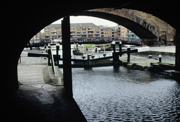
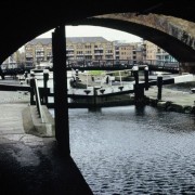
Limehouse Basin through the lock

Limehouse Basin through the lock

There’s plenty of more interesting sights if you leave the basin and explore Limehouse itself. The area has a sense of history and is notable for its links to some of the instigators of the modern welfare state. Limehouse Town Hall still stands. It’s where David Lloyd George made a famous 1909 speech condemning the House of Lords’ opposition to his peoples budget. Clement Atlee was also MP for the area before he became Prime Minister; its poverty moved his views leftwards. Another significant landmark is St. Anne’s Church, restored in 1854 after a fire. Next to the church is Limehouse Library, sadly boarded up but still a Grade II listed building.
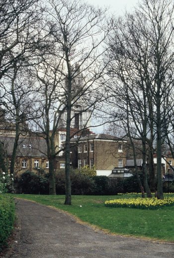
Limehouse retains many of its old buildings

Limehouse retains many of its old buildings

Once in Limehouse, find the Commercial Road (A13) and follow the signs for the Isle of Dogs, crossing by the cycle path. By Westferry station, you will see a path towards the Port East Apartments – there is access to the building and you can wander in the lobby before going through to West India Dock.

Canary Wharf now stands on the site of the docks as you cross the pontoon footbridge, you can see the Crossrail development to your left. If you don’t want to spend your money in the luxury shops here, find the Jubilee line station – it’s only 25 minutes back to West Hampstead.

Factbox
Distance: 7 miles (more depending on detours)
What to take: There are plenty of places to buy snacks or stop for a meal/pint
Maps: OS Explorer 173 London North (1:25,000) or an A-Z
Terrain: Flat, good paths and pavements. The towpath is good enough for cycling along on a Boris Bike. There are some steps.
Travel cost: £2.10/£1.70 train to St Pancras International and £2.80/£2.20 Canary Wharf to West Hampstead (peak/off-peak Oystercard fares).

View St Pancras to Canary Wharf in a larger map

Elstree & Borehamwood to Stanmore

This short six-mile jaunt from Hertfordshire back into London takes in a sailing club, horses, a stunningly rich private street, the former headquarters of Fighter Command, a ruined church and – the undoubted highlight – the chance to walk alongside the M1. Stick with me people.

Factbox ¦ Route map (full sizePhoto gallery

Elstree & Borehamwood, 14 minutes away, is as far north as an Oystercard will take you on the Thameslink, but – as one of the teenage girls who got off at the same time said to her friend – “it’s definitely not London.”

1_Elstree

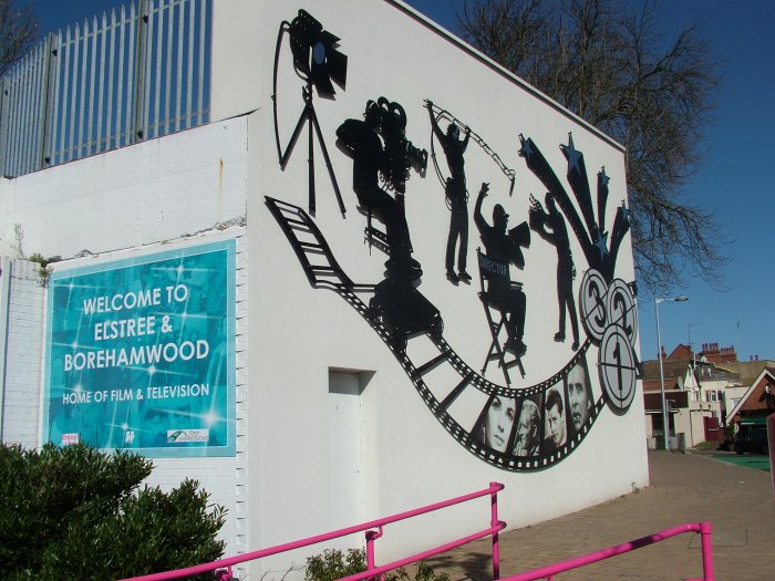
Elstree’s film heritage screams at you as soon as you step outside the station, but Allum Lane is hardly Hollywood Boulevard. It’s a bit of a climb up the hill through resolute suburbia until the views open up, fields replace well-tended gardens and the advertised Free Manure wafts into your nostrils. This is horse country, with liveries, stables and bridleways all the way to Stanmore, although we didn’t see anyone actually on horseback all afternoon.

It is possible to take a countryside detour that avoids some of Allum Lane, but it’s hard to get that excited about walking three sides of a square, when you can just zip down the road. To take the detour stick to the London Loop signs.

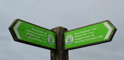
Regular readers will know that we’ve previously tackled sections of the Capital Ring, which is the inner circular loop. The London Loop is a similar, but longer route, on the very edge of the capital. It’s well signposted with the same small green singposts and waymarks. This walk takes in part of section 15 of the Loop.  And at the end of Allum Lane it takes you through a gate and across a field. Despite the strong spring sunshine, the faint path had plenty of give – a reminder of the wet winter from which we’ve just emerged.

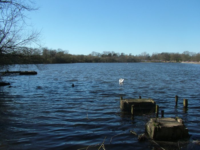
Planes from nearby Elstree aerodrome buzzed overhead – pilots taking advantage of one of the nicest weekends for months. Down on Aldenham Reservoir, the sailing club was also buzzy although there was no-one actually on the water.

2_AldenhamReservoir

I’m not one for sailing myself, though I understand the appeal. As hobbies go, it does seem to involve a lot of lugging things around. Men plodded around in wetsuits carrying equipment to and from sheds, while a friendly chap asked if we were interested in joining the club. We weren’t, but it’s amazing how nice it is to feel that somewhere is inclusive not exclusive.

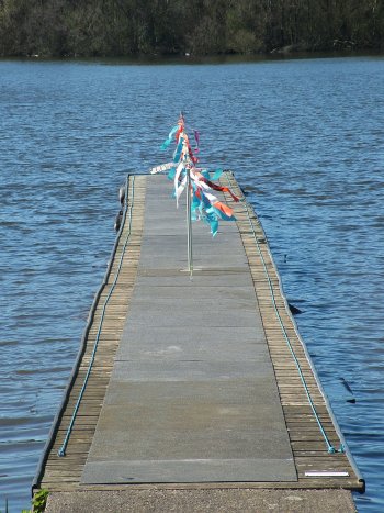
4_Pontoon

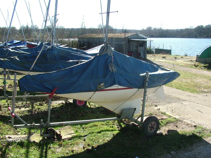
He told us about the strange tiny boats we could see. These are Illusion keelboats – the design is apparently the same as the original Americas Cup boats, but they are a fraction of the size.

3_Illusion

Aldenham has the second largest fleet of them in the country – they are more suitable for the “more mature sailors” apparently. Once you’re in, there’s not a lot to do other than steer and the lead in the keel makes then practically impossible to capsize. Here’s a photo of them in action.

A Great Crested Grebe bobbed by.

The path around the reservoir was busy with families out for a stroll. Wikipedia (infallible, as we know) tells us that the reservoir was hand dug by French prisoners of war between 1795 and 1797. You can easily circumnavigate the whole thing for a pleasant hour or so, but we pressed on. The London Loop rejoins the road, though you could continue to follow the reservoir path for another few hundred metres and cut back onto the road at a very unofficial break in the hedge.

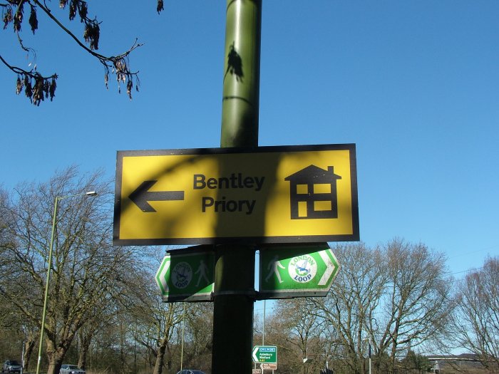
The least enjoyable part of the walk links the resevoir to the junction with the M1. We saw the first sign to Bentley Priory, but this was a yellow “housing development” sign rather than a brown “heritage attraction” sign. A hint at the next chapter in the unusual history of this 18th century stately home.

5_Bentley Priory

Ducking under the M1 the path immediately takes a left. It’s London Loop signposted but looks very unprepossessing with black plastic-covered hay bails suggesting there’s no access. At the far end of the field, with the hum of the motorway traffic receding, we came across more horses – one of which was particularly friendly though also seemed very keen on licking a fence post.

6_Horse

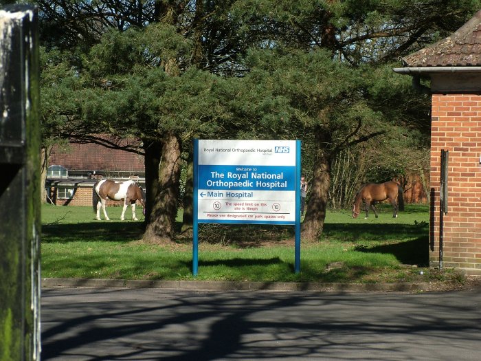
Up past more horses until we reached a junction. The footpath runs between the road and the fence, though it’s easy to miss and the road is not a public right of way. The path emerges at a back entrance to the Royal National Orthopaedic Hospital at what looks like the staff quarters and, rather oddly, there were a couple of horses (and people) on the grass inside the hospital grounds.

7_Hospital

Back on the road again, albeit this time a leafy lane rather than a thunderous A-road. Warren Lane skirts Stanmore Common, which is actually a wood, and there’s a small detour through the wood that brings you out at the car park. This is also a spot on the Bentley Priory circular walk – a four-mile loop that would make a nice extension to this walk.

There’s a very clear footpath sign at the next junction but it points towards a large gate and some forbidding signs. Press on!

8_Priory Drive sign

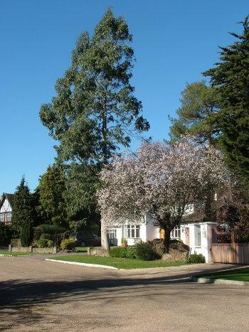
This is indeed the path and the side gate pushes open. This is Priory Drive, a small estate of some eye-wateringly large and expensive looking houses. According to the property websites they don’t change hands that often, and are worth less than you might imagine (a few million rather than many million).

9_Priory Drive

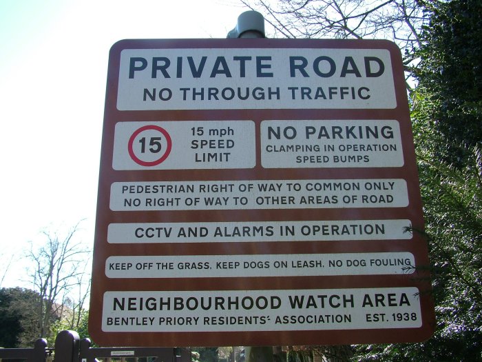
The residents association that clearly safeguards the area changed its name last year from the Priory Drive Residents Association to the Bentley Priory Residents Association, and incorporated as a company. Is this a pre-emptive move in the light of developments at Bentley Priory itself?

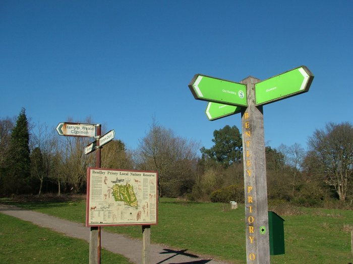
A large and unmissable signpost directs errant scruffs in walking boots out of this moneyed enclave and back onto the footpath, which leads to Bentley Priory Open Space and the first glimpse of the Priory itself.

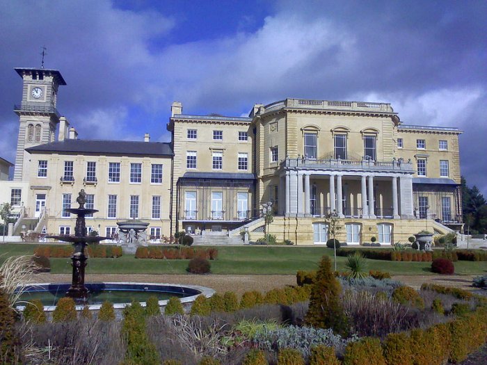
Bentley Priory was founded in 1171 and 600 years later, Sir John Soane designed a new house north of the original priory. Queen Adelaide, widow of William IV, died there in 1849 and between then and 1926, the building operated as a hotel and then a girl’s school.

In 1926, the Ministry of Defence bought the land and 10 years later it became the headquarters of Fighter Command. This was where Air Chief Marshal Sir Hugh Dowding was based and thus from where the Battle of Britain was managed.

On D-Day, Winston Churchill, President Eisenhower and King George VI were all together, monitoring the landings from the underground bunker.

Bentley Priory in February, Photo with permission from Roy Cousins

Bentley Priory in February, Photo with permission from Roy Cousins

It was also the home of the Observer Corps (later granted “Royal” status thanks to its work in the Battle of Britain), who were mostly civilians during the war, and were responsible for tracking aircraft once they had crossed the coast and into Britain. The Royal Observer Corps didn’t leave Bentley Priory until 1995 and the final units left the following year.

Eventually, the MoD sold the estate and the ensign was lowered for the final time on May 30th 2008.

The site is now being redeveloped as luxury homes and flats. Residences inside the original building home itself are being marketed by City and Country, while Barratt Homes is building new properties on site as well. However, the building’s military heritage is not being completely erased – after some protracted negotiations and a substantial donation from the developers, it was agreed that some of the rooms in the building could house the Bentley Priory Battle of Britain Trust museum. The museum opened last year though for guided tours only. It’s expected to open fully this year. For more photos, see Roy Cousins’ pictures.

On this walk, views of the building on this walk are obstructed by earthworks, but you can always follow the road round to the front entrance, or follow the signs (old and new) to skirt the estate for more glimpses.

10_old and new

We headed down through Heriot’s Wood and a deer park that was keeping children entertained as they threw carrots at the animals (who definitely preferred carrots to turnips) and emerged onto some open land with a large pond.

11_deer park

Minutes later and you’re in the built-up area of Stanmore. I knew next to nothing about Stanmore despite seeing the name every time I get the tube home. It turns out to be a fairly pleasant north-west London suburb with one remarkable feature – a ruined church in the grounds of another church.

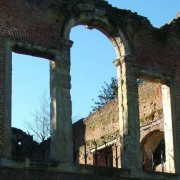
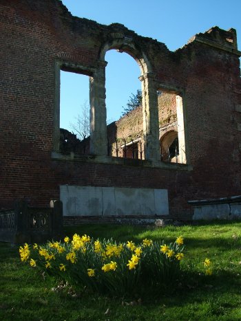
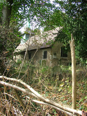
The red brick ruin is the original St John the Evangelist church. It dates from 1632, but although it looks like it suffered bomb damage, its dereliction predates the blitz by almost a century.

12_St John 1

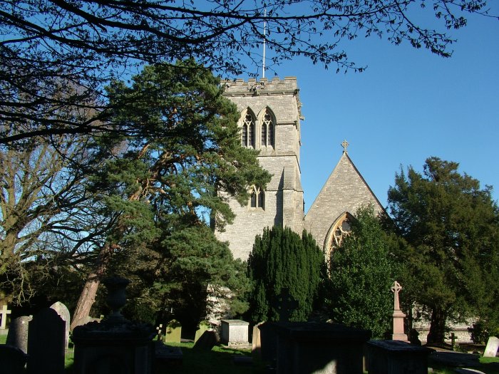
By 1850, it was deemed both too small and unsafe and the church next door – also St John the Evangelist – was consecrated. Permission was granted to demolish the old church, but a public outcry stopped this work after the roof and and part of the south wall had been taken down. The church was left as a ruin. In more recent times, work has been done to shore up the structure and make it safe. It is still consecrated and is occasionally used for services.

13_St John 2

Architectural critic Nicholas Pevsner decreed the brick church to be one of the finest ruins inMiddlesex, which may not be saying much. It’s open Saturday afternoons from April to September.

Stanmore tube station is a little outside the main drag. It was opened in 1932 and looks like a nice house from the street. From here, it’s a 20 minute trip back to West Hampstead.

Factbox
Distance: 6 miles
What to take: there are no shops between Elstree & Borehamwood and Stanmore, so take any snacks and drinks you might want. Unless it’s been very wet, trainers that you don’t mind getting dirty would be fine.
Maps: OS Explorer 173 London North (1:25,000)
Terrain: very gently undulating, good paths and pavement with a couple of fields to cross
Signposting: the London Loop is well signposted, but I’d still take the maps
Travel cost: £2.50 train, £1.50 tube (off-peak Oystercard fares).

View Elstree & Borehamwood to Stanmore in a larger map

Chelsea to Richmond

“This is the 328 to Chelsea, World’s End”. We’ve all heard the announcement, but how many of you have ridden the bus all the way to the end of the world? It’s just over an hour from West End Lane but a good start to this 12 mile walk that takes in two rivers, the “other” Wimbledon tennis courts, a windmill, and an amazing view of St Paul’s Cathedral from the wrong side of London. Much of the walk is on the Capital Ring.

Factbox ¦ Route map (full size) ¦ Slideshow

The 328 is one of London’s more interesting bus routes – encompassing some of the wealthiest and most deprived parts of the capital. It may be a little short of famous attractions (Portobello Road is pretty much the highlight), but it’s a microcosm of the city as a whole.

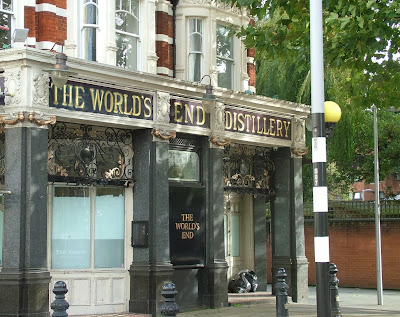
You should actually get off one stop before the terminus, at Hobury Street. Then double back on yourself to head to the river. Just past the bus stop you’ll see the World’s End, which is not an apocalyptic black hole but a pub and large 1970s council estate.

You’ll need a map – paper or digital – to help you find your way to the Thames Path, which in theory you’d follow all the way to Wandsworth Bridge. In practice, there’s so much development going on around this part of Chelsea at the moment that the path weaves rather confusingly around building sites and through car parks. You might want to take the shortest walking route to the bridge along the main road.

That would, however, mean missing out on a few gems. First, what’s left of one-time pleasure park, Cremorne Gardens. There’s also a public pier where we got the obligatory Shard view before looking west into the winter sun.

In the gardens themselves, which you can enter through a redundant yet ornate gate, there is a bizarrely delightful jumble of birdhouses on a tree courtesy of the Secret Garden Project. Avian high-rise living at its most stylish.

As you enter the maze around Imperial Wharf, there’s a chance to get a glimpse of Battersea Power Station before its demolished and rebuilt. Trust to the Thames Path signs, even though they seem to lead you into a hotel. The housing developments around Imperial Wharf are unappealing and look uninhabited on this bright, chilly, windy weekend. We’re forced onto a diversion from the riverside path through a “sensory garden”, although the main sensation is one of slipping on the muddy path that has been worn into the lawn.

It’s not far from the bus stop to Wandsworth Bridge, but with all the detours it feels like a long way. You might want to cheat and change buses somewhere around Kensington onto the 28 bus, which will take you all the way to Garratt Lane from where the walk really begins.

The York Road roundabout is a busy affair, and you don’t need to venture into the subways where Kubrick’s version of the Droogs drat the Ded in A Clockwork Orange. Follow the Cycle Superhighway signs to cut through Old York Street, which is a lovely street with independent cafés and shops and the sort of place that makes you wonder whether south of the river isn’t so bad after all.

This was my first time on Wandsworth’s main shopping drag – an anodyne retail strip with a large shopping mall and an enormo-Sainsbury’s that’s being rebuilt. It’s pleasant enough but we leave the bus lanes here and hit the Wandle Trail. The Wandle is sometimes referred to as one of London’s “lost rivers”, but it’s not lost at all – it’s right here and you can walk or cycle along most of it. It’s not much to look at at this point: there’s a number plate lying in the shallow water and the path veers away from it fairly quickly, letting us watch some sweaty middle-aged men play five-a-side.

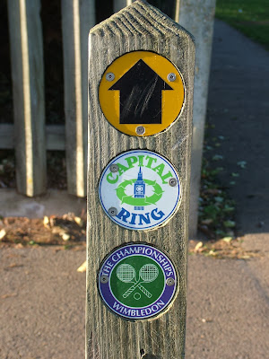
After a lunch stop in the park, it’s into Earlsfield and – let joy be unconfined – we link up with our old friend the Capital Ring, which we were on in the last whampwalk, and which takes us all the way to Richmond. The signposting is excellent, so you can put the map away for a bit.

Wimbledon Park tube station is the last easy place to bail out of this walk and is at the top of a parade of shops that seem to be entirely geared towards weddings – a wedding dress shop, a bridesmaids’ dress shop and a wedding cake shop all in close proximity.

We turn right into Wimbledon Park itself and are confronted with an expanse of tennis courts. Not, of course, the hallowed turf of the All England Club, but the local public courts, which are in good condition although being underused on this sunny Sunday afternoon.

Wimbeldon Park – a Capability Brown park, once owned by the Spencers (as in Diana) – has a playground and a cafe. Standard stuff. It also has a large lake and a full size athletics stadium, both of which it’s possible to miss without realising they’re there.

The Capital Ring circumnavigates both – indeed the only sign of the athletics track is an unloved podium buried in the undergrowth behind the high steel fence. Our attention is drawn, however, by the pyre of pallets ready for Bonfire Night, and by three men from the funfair who are practicing some sort of shield and sword play.

We do glance into the athletics track – the noticeboard suggests it’s still very much in use by the Hercules Athletics Club – but when empty it feels like a rather depressing Olympic legacy.

It’s a short walk from Wimbledon Park to its more famous neighbour Wimbledon Common. If you want to peek at the more famous tennis courts, keep heading down Church Road, but there’s not much to see from the outside. On our way to meet the Wombles, we pass some very grand expensive houses, and one that’s seen better days. A tree that came down in the St Jude Storm has taken out a road sign.

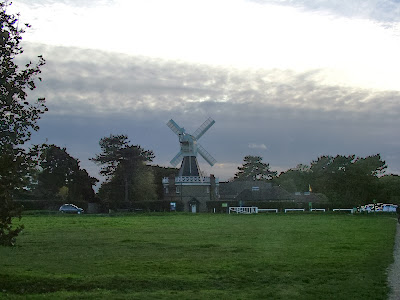
This entrance to Wimbledon Common is unprepossessing and for once the signs aren’t clear – take the left-middle fork. The walk notes keep banging on about a windmill, which seems preposterous until we come across it, jutting into the sky like something from a Constable – albeit if the Hay Wain had a golf course and café next to it. [Windmill fact: this is the last remaining hollow post flour mill in the country, bread fans!]

The common itself is more like Hampstead Heath then the more manicured park we’ve just left. We make our way past the club house of the London Scottish golf course and downhill, checking to our left for flying golf balls. A war memorial is just visible, obscured by trees as the Capital Ring path sticks to the woodland rather than the open playing fields.

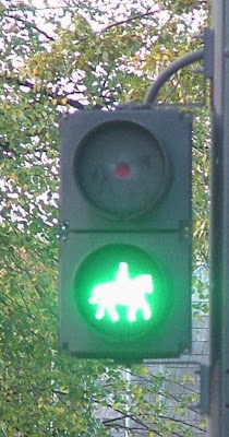
Emerging from Wimbledon Common, we come across an unsual feature – an equestrian crossing. First, there’s a standard push-button crossing box… at horse height, then a sign that separates pedestrian from equine traffic and finally a special mounted rider green light crossing signal. This is a dual carriageway and the horses have to go through a high-fenced corral in the central reservation – surely some must still get spooked by the noise?

We enter Richmond Park through Robin Hood Gate – one of the six original entrances to the park, and named after a nearby inn. We’re heading up the hill past the amusingly named Spankers Hill Wood (on your right). It’s starting to feel wintry, the sun is setting fast and although there are plenty of people strolling around, the sense is that most are heading back to their cars. We still have a few miles to go though.

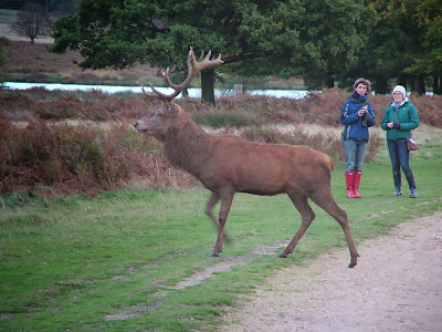
Richmond Park is perhaps most famous for its deer and it’s not long before we spot a fine stag making its way through the dried bracken before brazenly crossing the path. The light is too poor for a good quick photo, but that doesn’t stop me or plenty of others from trying.

Just before the brow of the hill after Pen Ponds, a smallish waymarker sends you to the left. An amazingly squat old oak tree acts as a handy beacon before the path heads towards a main road. Away from the people and in the dusk, it’s a bit spooky – the feeling is heightened by the bellowing of deer in the woodland.

The lights of Pembroke Lodge were twinkling above us. The Lodge is now a cafe, but was once the childhood home of Bertrand Russell (whose father was the prime minister at the time), the home of the Countess of Pembroke and before that… the park’s molecatcher

The sun was now below the horizon, so we thought twice about taking the tiny detour to King Henry’s Mound. We shouldn’t have thought at all – this is a hidden marvel. It’s believed to be a bronze age burial site, and is the highest point in the park. There’s a telescope up there, which faces west towards Windsor and Heathrow.

The walk description said “The view of St Paul’s Cathedral is amazing”. But St Paul’s is east of Richmond. So that was clearly wron…. Hang on. Swinging the telescope round to look at a hedge revealed a tiny gap in the iron railings and there, down an arrow straight gap in the trees, was the dome of St Paul’s. Given the hour, the cathedral was lit by its spotlights and stood out clearly – one of the protected views of St Paul’s that are enshrined in London planning legislation.

From here, it’s a couple of minutes down a steep grass slope to the gate out of the park. By the time we took the path to the right of the Dysart Arms it was dark and we crossed Petersham Meadows in what Victorian novelists would have called the “gloaming” until we rejoined the Thames Path many miles from where we’d started.

Richmond was buzzing but all we wanted was a coffee and the 26 minute train ride back to West Hampstead.

Factbox
Distance: 12 miles (9 miles if you take the 28 bus to Wandsworth)
What to take: The path could be muddy in places, so not your best shoes. There are shops in Wandsworth, Wimbledon and Richmond to stock up on snacks, but it’s a longish walk so I’d take some food and water with you.
Maps: Once you hit Wandsworth, you’re on the Wandle Walk for a bit and then a short bit of Section 5 and all of Section 6 of the Capital Ring. I would recommend OS Explorer 161 London South (1:25,000), which marks the Capital Ring.
Terrain: well-maintained paths and pavement, fairly flat.
Signposting: Once you’re on the Capital Ring, signposting is excellent. Before that, a map is very helpful indeed.
Travel cost: £1.40 bus; £1.50 train (for Oyster card holders).

View World’s End to Richmond via Wimbledon in a larger map

(can’t see the photos? Go to the Flickr page)

Previous walks:
Welsh Harp Reservoir and Fryent Country Park

Welsh Harp & Fryent Country Park

Our first (half) day out, is a late summer six-mile ramble through Brent and Barnet that starts just six minutes from West Hampstead! On this Sunday afternoon, we watched swans corralling signets in Welsh Harp reservoir, discovered Brent’s oldest building, ate a wild apple, and still couldn’t avoid spotting the Shard.

Factbox ¦ Route map (full size) ¦ Slideshow

Our path was one section of the Capital Ring – a sort of pedestrian M25 that circles London.

We took the Thameslink north to Hendon (£1.70 with Oyster travelcard) – it really is just six minutes. A brisk cut across Hendon Broadway with its seemingly incongruous fishing tackle shop took us to the glorious leafy surrounds of Cool Oak Lane. There were indeed some cool-looking oaks on this shady walkway, already laden with acorns. There’s a narrow bridge that has its own pedestrian light – when the man goes green the cars have to stop and you can saunter across the bridge. Then head left – despite signs pointing both left and right.

The bridge takes you away from built-up Hendon and into parkland. There’s a lookout platform across the Welsh Harp (aka Brent) Reservoir. This is one of London’s largest lakes and an important conservation area for many bird and mammal species. It’s also home to a sailing centre and there were kids in canoes enjoying the water. Standing in this peaceful spot it was hard to believe we’d been on West End Lane less than half an hour previously. Welsh Harp is named after a pub by the way – I knew you’d ask

Don’t leave it too long before trying this walk – the Welsh Harp area looks like it’s going to be built on in a very controversial large-scale housing development. From a purely environmental point of view, this seems like a terrible shame. To have such open countryside in the heart of north London is fantastic.

Having walked the length of the reservoir, where there are numerous picnic spots and a few hidden nooks and crannies, we stumbled upon St Andrew’s Old Church (not to be confused with the new St Andrew’s round the corner). The Capital Ring signs don’t take you past the church, instead take the footpath signed “Leading to St Andrew’s Road” and make your way through the spooky graveyard to find it. An ice cream van’s jingle in the distance only added to the horror film vibe.

Amazingly, the church is thought to be the oldest standing building in Brent, dating back to Saxon times. As we approached it seemed a service was ending, but the garb of the small congregation and the priest suggested this wasn’t your run-of-the-mill CofE service. Instead, the church is now home to Romanian Orthodox worshippers. Brent council has a fantastic article on the history of the building, which I wish we’d read before we went.

You soon pick up the Capital Ring path again as it makes it way through the paved front gardens of suburbia to Fryent Country Park. The views open up to the north and it feels as if you have left London behind. The park is more of a heathland with original hedgerows and paths in all directions. The Capital Ring path is well signposted, and where there are multiple paths, look at the directional arrow carefully although there are plenty of ways of getting to the busy main road that bisects the park.

There were sloes, blackberries and even apples in abundance in the park. The latter offshoots presumably of nearby orchards. Aside from a lone jogger, we had the whole area to ourselves, even on a sunny mild Sunday afternoon.

After crossing the road, the park becomes more of a wood, and the path takes the only major climb of the route – a short pull up to Barn Hill.

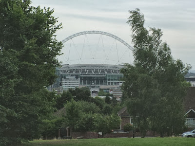
Having barely seen a soul since entering Fryent Park, there were a few families enjoying the pond up here, replete with moorhens. The views of Wembley stadium from the trig point must be hard to beat, and a clearing to the east lets you glimpse the glass and steel structures of the City – the Gherkin and Shard both visible in the haze. For some reason there was a watermelon cut in half and lying on the grass as if picnickers had been forced to leave in a hurry and feared it might weigh them down as they fled.

Coming down from Barn Hill, there’s a temptation to cross the Jubilee Line footbridge, but in fact the path turns left and then disappears right, into a small copse – the signpost is completely overgrown though, but even making a mistake here will lead you back onto the path.

The wilder parts of the walk are behind you – although some might find Preston Road a little wilder than West End Lane. Here’s refreshment in the form of some corner shops (one of which was selling doner kebab flavour crisps!). This is also a bailing out point as you can catch the Met Line from here.

As you reach the picture perfect village school that is Preston Park primary, the path cuts through an appealing small urban park with a playground and cricket pitch (there was a match, but it was tea). Another trip through suburbia the other side and under South Kenton station and you’re almost at Northwick Park.

Here the view is dominated by the enormous hospital, and by military aircraft flying into RAF Northolt. There were a couple more cricket matches here; it was tea here too – at least for the more serious looking one. The Capital Ring takes a very unprepossessing route off through some brambles but we headed on the spur path to Northwick Park station. From here, it’s a 12 minute ride on the Metropolitan Line (£1.50 off-peak) to Finchley Road station and back to the sanctity of NW6.

Factbox
What to take: The path could be muddy, so not your best shoes. There are shops in Hendon and Preston Road, but that’s about it, so you may want some water/snacks.
Maps: Most of the walk is on Section 10 of the Capital Ring. Here’s the map. (this describes the route in reverse). I would recommend OS Explorer 173 London North (1:25,000), which marks the path as well.
Terrain: well-maintained paths and pavement, undulating, with one steeper section of up/down
Distance: 6.5 miles
Signposting: Very well signposted for the most part, though some signs are small. Map definitely recommended.
View Welsh Harp and Fryent Park in a larger map
(can’t see the photos? Go to the Flickr page)