Chelsea to Richmond
“This is the 328 to Chelsea, World’s End”. We’ve all heard the announcement, but how many of you have ridden the bus all the way to the end of the world? It’s just over an hour from West End Lane but a good start to this 12 mile walk that takes in two rivers, the “other” Wimbledon tennis courts, a windmill, and an amazing view of St Paul’s Cathedral from the wrong side of London. Much of the walk is on the Capital Ring.
Factbox ¦ Route map (full size) ¦ Slideshow
The 328 is one of London’s more interesting bus routes – encompassing some of the wealthiest and most deprived parts of the capital. It may be a little short of famous attractions (Portobello Road is pretty much the highlight), but it’s a microcosm of the city as a whole.
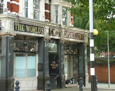
You should actually get off one stop before the terminus, at Hobury Street. Then double back on yourself to head to the river. Just past the bus stop you’ll see the World’s End, which is not an apocalyptic black hole but a pub and large 1970s council estate.
You’ll need a map – paper or digital – to help you find your way to the Thames Path, which in theory you’d follow all the way to Wandsworth Bridge. In practice, there’s so much development going on around this part of Chelsea at the moment that the path weaves rather confusingly around building sites and through car parks. You might want to take the shortest walking route to the bridge along the main road.
That would, however, mean missing out on a few gems. First, what’s left of one-time pleasure park, Cremorne Gardens. There’s also a public pier where we got the obligatory Shard view before looking west into the winter sun.
In the gardens themselves, which you can enter through a redundant yet ornate gate, there is a bizarrely delightful jumble of birdhouses on a tree courtesy of the Secret Garden Project. Avian high-rise living at its most stylish.
As you enter the maze around Imperial Wharf, there’s a chance to get a glimpse of Battersea Power Station before its demolished and rebuilt. Trust to the Thames Path signs, even though they seem to lead you into a hotel. The housing developments around Imperial Wharf are unappealing and look uninhabited on this bright, chilly, windy weekend. We’re forced onto a diversion from the riverside path through a “sensory garden”, although the main sensation is one of slipping on the muddy path that has been worn into the lawn.
It’s not far from the bus stop to Wandsworth Bridge, but with all the detours it feels like a long way. You might want to cheat and change buses somewhere around Kensington onto the 28 bus, which will take you all the way to Garratt Lane from where the walk really begins.
The York Road roundabout is a busy affair, and you don’t need to venture into the subways where Kubrick’s version of the Droogs drat the Ded in A Clockwork Orange. Follow the Cycle Superhighway signs to cut through Old York Street, which is a lovely street with independent cafés and shops and the sort of place that makes you wonder whether south of the river isn’t so bad after all.
This was my first time on Wandsworth’s main shopping drag – an anodyne retail strip with a large shopping mall and an enormo-Sainsbury’s that’s being rebuilt. It’s pleasant enough but we leave the bus lanes here and hit the Wandle Trail. The Wandle is sometimes referred to as one of London’s “lost rivers”, but it’s not lost at all – it’s right here and you can walk or cycle along most of it. It’s not much to look at at this point: there’s a number plate lying in the shallow water and the path veers away from it fairly quickly, letting us watch some sweaty middle-aged men play five-a-side.
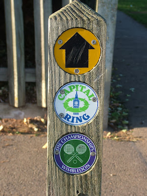
After a lunch stop in the park, it’s into Earlsfield and – let joy be unconfined – we link up with our old friend the Capital Ring, which we were on in the last whampwalk, and which takes us all the way to Richmond. The signposting is excellent, so you can put the map away for a bit.
Wimbledon Park tube station is the last easy place to bail out of this walk and is at the top of a parade of shops that seem to be entirely geared towards weddings – a wedding dress shop, a bridesmaids’ dress shop and a wedding cake shop all in close proximity.
We turn right into Wimbledon Park itself and are confronted with an expanse of tennis courts. Not, of course, the hallowed turf of the All England Club, but the local public courts, which are in good condition although being underused on this sunny Sunday afternoon.
Wimbeldon Park – a Capability Brown park, once owned by the Spencers (as in Diana) – has a playground and a cafe. Standard stuff. It also has a large lake and a full size athletics stadium, both of which it’s possible to miss without realising they’re there.
The Capital Ring circumnavigates both – indeed the only sign of the athletics track is an unloved podium buried in the undergrowth behind the high steel fence. Our attention is drawn, however, by the pyre of pallets ready for Bonfire Night, and by three men from the funfair who are practicing some sort of shield and sword play.
We do glance into the athletics track – the noticeboard suggests it’s still very much in use by the Hercules Athletics Club – but when empty it feels like a rather depressing Olympic legacy.
It’s a short walk from Wimbledon Park to its more famous neighbour Wimbledon Common. If you want to peek at the more famous tennis courts, keep heading down Church Road, but there’s not much to see from the outside. On our way to meet the Wombles, we pass some very grand expensive houses, and one that’s seen better days. A tree that came down in the St Jude Storm has taken out a road sign.
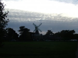
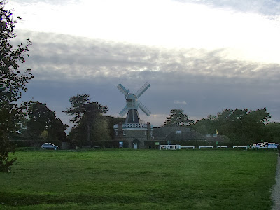
This entrance to Wimbledon Common is unprepossessing and for once the signs aren’t clear – take the left-middle fork. The walk notes keep banging on about a windmill, which seems preposterous until we come across it, jutting into the sky like something from a Constable – albeit if the Hay Wain had a golf course and café next to it. [Windmill fact: this is the last remaining hollow post flour mill in the country, bread fans!]
The common itself is more like Hampstead Heath then the more manicured park we’ve just left. We make our way past the club house of the London Scottish golf course and downhill, checking to our left for flying golf balls. A war memorial is just visible, obscured by trees as the Capital Ring path sticks to the woodland rather than the open playing fields.
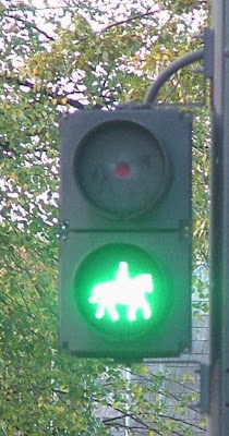
Emerging from Wimbledon Common, we come across an unsual feature – an equestrian crossing. First, there’s a standard push-button crossing box… at horse height, then a sign that separates pedestrian from equine traffic and finally a special mounted rider green light crossing signal. This is a dual carriageway and the horses have to go through a high-fenced corral in the central reservation – surely some must still get spooked by the noise?
We enter Richmond Park through Robin Hood Gate – one of the six original entrances to the park, and named after a nearby inn. We’re heading up the hill past the amusingly named Spankers Hill Wood (on your right). It’s starting to feel wintry, the sun is setting fast and although there are plenty of people strolling around, the sense is that most are heading back to their cars. We still have a few miles to go though.
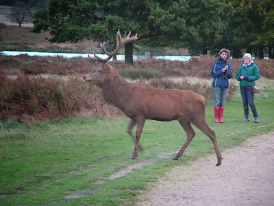
Richmond Park is perhaps most famous for its deer and it’s not long before we spot a fine stag making its way through the dried bracken before brazenly crossing the path. The light is too poor for a good quick photo, but that doesn’t stop me or plenty of others from trying.
Just before the brow of the hill after Pen Ponds, a smallish waymarker sends you to the left. An amazingly squat old oak tree acts as a handy beacon before the path heads towards a main road. Away from the people and in the dusk, it’s a bit spooky – the feeling is heightened by the bellowing of deer in the woodland.
The lights of Pembroke Lodge were twinkling above us. The Lodge is now a cafe, but was once the childhood home of Bertrand Russell (whose father was the prime minister at the time), the home of the Countess of Pembroke and before that… the park’s molecatcher
The sun was now below the horizon, so we thought twice about taking the tiny detour to King Henry’s Mound. We shouldn’t have thought at all – this is a hidden marvel. It’s believed to be a bronze age burial site, and is the highest point in the park. There’s a telescope up there, which faces west towards Windsor and Heathrow.
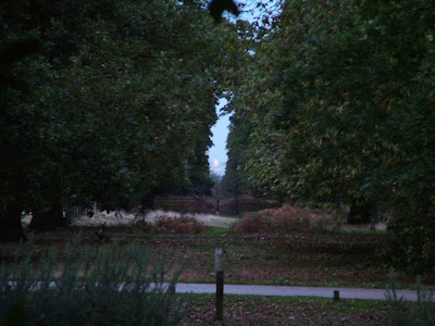
The walk description said “The view of St Paul’s Cathedral is amazing”. But St Paul’s is east of Richmond. So that was clearly wron…. Hang on. Swinging the telescope round to look at a hedge revealed a tiny gap in the iron railings and there, down an arrow straight gap in the trees, was the dome of St Paul’s. Given the hour, the cathedral was lit by its spotlights and stood out clearly – one of the protected views of St Paul’s that are enshrined in London planning legislation.
From here, it’s a couple of minutes down a steep grass slope to the gate out of the park. By the time we took the path to the right of the Dysart Arms it was dark and we crossed Petersham Meadows in what Victorian novelists would have called the “gloaming” until we rejoined the Thames Path many miles from where we’d started.
Richmond was buzzing but all we wanted was a coffee and the 26 minute train ride back to West Hampstead.
Distance: 12 miles (9 miles if you take the 28 bus to Wandsworth)
What to take: The path could be muddy in places, so not your best shoes. There are shops in Wandsworth, Wimbledon and Richmond to stock up on snacks, but it’s a longish walk so I’d take some food and water with you.
Maps: Once you hit Wandsworth, you’re on the Wandle Walk for a bit and then a short bit of Section 5 and all of Section 6 of the Capital Ring. I would recommend OS Explorer 161 London South (1:25,000), which marks the Capital Ring.
Terrain: well-maintained paths and pavement, fairly flat.
Signposting: Once you’re on the Capital Ring, signposting is excellent. Before that, a map is very helpful indeed.
Travel cost: £1.40 bus; £1.50 train (for Oyster card holders).
View World’s End to Richmond via Wimbledon in a larger map
Previous walks:
Welsh Harp Reservoir and Fryent Country Park




Thanks for this. I might take my family on this walk when they come to visit.